-

Telephone Exchange and Box, West Bretton
-
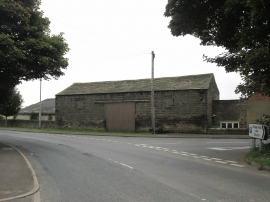
Barn at Town Farm , West Bretton
Telephone Exchange and Box, West Bretton
Barn at Town Farm , West Bretton
Other current and historical names
Location and coordinates are for the approximate centre of West Bretton within this administrative area. Geographic features and populated places may cross administrative borders.