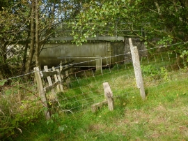
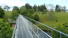
Park of Drumquhassle, Stirling

« Gazetteer Entry
Upload Photo

Park of Drumquhassle, Stirling

  • Unitary Authority: Stirling
  • Region: Scotland
  • Category: Landcover
  • Type: Forest or Wood
  • Latitude/Longitude: 56°2'50"N 4°26'1"W
  • Eastings/Northings: 248500, 686500
  • OS Grid: NS485865
  • Mapcode Local: GBR 0R.R5WF
  • Mapcode Global: WH3N6.V8TD

Location and coordinates are for the approximate centre of Park of Drumquhassle within this administrative area. Geographic features and populated places may cross administrative borders.

BritishPlaceNames.uk is a Good Stuff website.