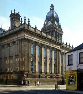
Leeds, England

« Gazetteer Entry
Upload Photo

Leeds, England

Other current and historical names

  • Leedes
  • Ledes
  • Leodys
  • Loidis
  • Loytes
  • Crown Point
  • Quarry Hill
  • Leeds Bradford and Halifax Junction
  • Built-Up Area: Leeds
  • Parish/Community: Leeds, unparished area
  • Unitary Authority: Leeds
  • Region: Yorkshire and The Humber
  • Category: Populated Place
  • Type: City
  • Latitude/Longitude: 53°48'2"N 1°33'0"W
  • Eastings/Northings: 429719, 433916
  • OS Grid: SE297339
  • Mapcode Local: GBR BHK.KB
  • Mapcode Global: WHC9D.5Q1P

Location and coordinates are for the approximate centre of Leeds within this administrative area. Geographic features and populated places may cross administrative borders.

BritishPlaceNames.uk is a Good Stuff website.