Notts - NG15 (Annesley Hall Area)
Uploader's Comments
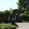
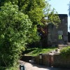
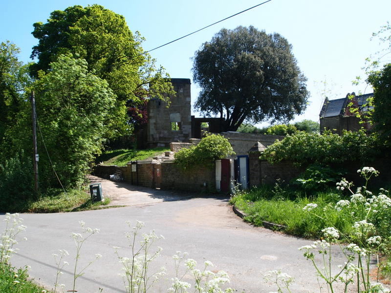
This is the cul-de-sac at the end of the slip road that feeds in from the left of this picture. The slip road branches off the Mansfield Road. To the right (behind the cow parsley) is a low barrier and the start of a footpath that follows one of Annesley Hall's boundary walls. Behind the crudely boarded up entrance lies a courtyard that previously served a wing of Annesley Hall; in the centre of the picture is the tower of the 12th century former Annesley Church and beyond the up-ended wooden pallet lies an unmade path that leads to some steps, the graveyard and ultimately the ruined church.
Uploaded to Geograph by David Hallam-Jones on 26 May 2012