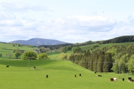
Yellowdales Plantation, South Lanarkshire

« Gazetteer Entry
Upload Photo

Yellowdales Plantation, South Lanarkshire

  • Unitary Authority: South Lanarkshire
  • Region: Scotland
  • Category: Landcover
  • Type: Forest or Wood
  • Latitude/Longitude: 55°38'53"N 3°30'56"W
  • Eastings/Northings: 304718, 640436
  • OS Grid: NT047404
  • Mapcode Local: GBR 33W4.P4
  • Mapcode Global: WH5SV.Z92F

Location and coordinates are for the approximate centre of Yellowdales Plantation within this administrative area. Geographic features and populated places may cross administrative borders.

BritishPlaceNames.uk is a Good Stuff website.