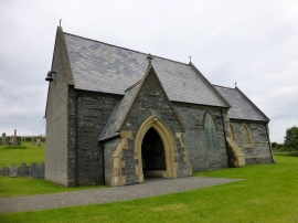
Y Ferwig, Ceredigion

« Gazetteer Entry
Upload Photo

Y Ferwig, Ceredigion

Other current and historical names

  • Ferwig
  • Verwig
  • Verwick
  • Ferwig, Y
  • Parish/Community: Y Ferwig
  • Unitary Authority: Ceredigion
  • Region: Wales
  • Category: Populated Place
  • Type: Village
  • Latitude/Longitude: 52°6'52"N 4°39'10"W
  • Eastings/Northings: 218441, 249589
  • OS Grid: SN184495
  • Mapcode Local: GBR D0.8SLX
  • Mapcode Global: VH2MP.93GP

Location and coordinates are for the approximate centre of Y Ferwig within this administrative area. Geographic features and populated places may cross administrative borders.

BritishPlaceNames.uk is a Good Stuff website.