-

Wayfarer Inn on Willen Lake with Big Bob in the background
-
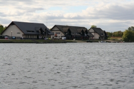
Hotel and leisure centre on Willen lake
Wayfarer Inn on Willen Lake with Big Bob in the background
Hotel and leisure centre on Willen lake
Location and coordinates are for the approximate centre of Willen Lake within this administrative area. Geographic features and populated places may cross administrative borders.