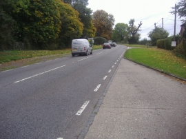
Wendover Dean, Buckinghamshire

« Gazetteer Entry
Upload Photo

Wendover Dean, Buckinghamshire

  • Parish/Community: Wendover
  • District/Borough: Aylesbury Vale
  • County: Buckinghamshire
  • Region: South East
  • Category: Populated Place
  • Type: Hamlet
  • Latitude/Longitude: 51°44'4"N 0°44'10"W
  • Eastings/Northings: 487375, 204734
  • OS Grid: SP873047
  • Mapcode Local: GBR D40.6Q0
  • Mapcode Global: VHDVL.6N5P

Location and coordinates are for the approximate centre of Wendover Dean within this administrative area. Geographic features and populated places may cross administrative borders.

BritishPlaceNames.uk is a Good Stuff website.