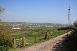
Watton, Dorset

« Gazetteer Entry
Upload Photo

Watton, Dorset

Other current and historical names

  • Highlands
  • Parish/Community: Symondsbury
  • District/Borough: West Dorset
  • County: Dorset
  • Region: South West
  • Category: Populated Place
  • Type: Village
  • Latitude/Longitude: 50°43'14"N 2°46'24"W
  • Eastings/Northings: 345500, 91500
  • OS Grid: SY455915
  • Mapcode Local: GBR PP.10Y7
  • Mapcode Global: FRA 5725.PC7

Location and coordinates are for the approximate centre of Watton within this administrative area. Geographic features and populated places may cross administrative borders.

BritishPlaceNames.uk is a Good Stuff website.