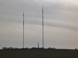
Watford Gap, Birmingham

« Gazetteer Entry
Upload Photo

Watford Gap, Birmingham

  • Parish/Community: Sutton Coldfield
  • Unitary Authority: Birmingham
  • Region: West Midlands
  • Category: Populated Place
  • Type: Other Settlement
  • Latitude/Longitude: 52°36'7"N 1°49'53"W
  • Eastings/Northings: 411500, 300500
  • OS Grid: SK115005
  • Mapcode Local: GBR 3D8.ZP1
  • Mapcode Global: WHCH1.TVZH

Location and coordinates are for the approximate centre of Watford Gap within this administrative area. Geographic features and populated places may cross administrative borders.

BritishPlaceNames.uk is a Good Stuff website.