-

View from Walney Bridge (1)
-
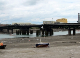
Jubilee Bridge crossing Walney Channel
View from Walney Bridge (1)
Jubilee Bridge crossing Walney Channel
Location and coordinates are for the approximate centre of Vickerstown within this administrative area. Geographic features and populated places may cross administrative borders.