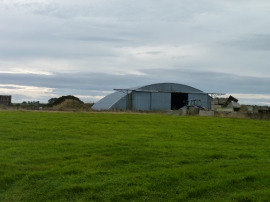
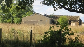
Upper Kenley, Fife

« Gazetteer Entry
Upload Photo

Upper Kenley, Fife

Other current and historical names

  • Kenley, Upper
  • Unitary Authority: Fife
  • Region: Scotland
  • Category: Populated Place
  • Type: Other Settlement
  • Latitude/Longitude: 56°17'38"N 2°42'15"W
  • Eastings/Northings: 356500, 711500
  • OS Grid: NO565115
  • Mapcode Local: GBR 2V.7JC6
  • Mapcode Global: WH7SF.F2FB

Location and coordinates are for the approximate centre of Upper Kenley within this administrative area. Geographic features and populated places may cross administrative borders.

BritishPlaceNames.uk is a Good Stuff website.