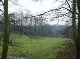
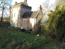
Upper Glen Plantation, Falkirk

« Gazetteer Entry
Upload Photo

Upper Glen Plantation, Falkirk

  • Unitary Authority: Falkirk
  • Region: Scotland
  • Category: Landcover
  • Type: Forest or Wood
  • Latitude/Longitude: 55°58'22"N 3°56'50"W
  • Eastings/Northings: 278561, 677249
  • OS Grid: NS785772
  • Mapcode Local: GBR 1C.WM53
  • Mapcode Global: WH4PZ.B4HH

Location and coordinates are for the approximate centre of Upper Glen Plantation within this administrative area. Geographic features and populated places may cross administrative borders.

BritishPlaceNames.uk is a Good Stuff website.