-

Coastal East Lothian : There and Back at Tyne Sands
-
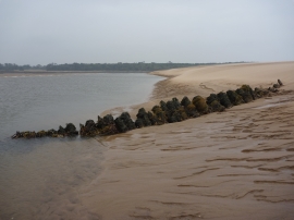
Coastal East Lothian : Shipwreck on the Tyne Sands - 10 October 2010
Coastal East Lothian : There and Back at Tyne Sands
Coastal East Lothian : Shipwreck on the Tyne Sands - 10 October 2010
Location and coordinates are for the approximate centre of Tyne Sands within this administrative area. Geographic features and populated places may cross administrative borders.