-
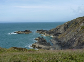
Pen Peles - rocks and cliffs below the Coastal Path
-
Creigiau Pen-Peles Rocks
Pen Peles - rocks and cliffs below the Coastal Path
Creigiau Pen-Peles Rocks
Location and coordinates are for the approximate centre of Traeth Bach Llwyn Ysgaw within this administrative area. Geographic features and populated places may cross administrative borders.