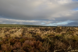
Tod Knowe, Northumberland

« Gazetteer Entry
Upload Photo

Tod Knowe, Northumberland

  • Parish/Community: Hepple
  • Unitary Authority: Northumberland
  • Region: North East
  • Category: Geographic Feature
  • Type: Hill or Mountain
  • Latitude/Longitude: 55°14'40"N 2°1'30"W
  • Eastings/Northings: 398500, 594500
  • OS Grid: NY985945
  • Mapcode Local: GBR G79S.CQ
  • Mapcode Global: WHB11.VFVP

Location and coordinates are for the approximate centre of Tod Knowe within this administrative area. Geographic features and populated places may cross administrative borders.

BritishPlaceNames.uk is a Good Stuff website.