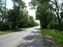
The Hallands, North Lincolnshire

« Gazetteer Entry
Upload Photo

The Hallands, North Lincolnshire

Other current and historical names

  • Hallands, The
  • Parish/Community: Goxhill
  • Unitary Authority: North Lincolnshire
  • Region: Yorkshire and The Humber
  • Category: Populated Place
  • Type: Other Settlement
  • Latitude/Longitude: 53°40'10"N 0°20'38"W
  • Eastings/Northings: 509500, 420500
  • OS Grid: TA095205
  • Mapcode Local: GBR VV10.99
  • Mapcode Global: WHGG4.P1C6

Location and coordinates are for the approximate centre of The Hallands within this administrative area. Geographic features and populated places may cross administrative borders.

BritishPlaceNames.uk is a Good Stuff website.