-
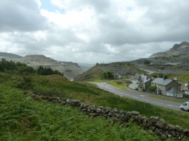
A470 descending to Blaenau Ffestiniog
-
Blaenau Ffestiniog - 1980
A470 descending to Blaenau Ffestiniog
Blaenau Ffestiniog - 1980
Location and coordinates are for the approximate centre of Tal-y-waenydd within this administrative area. Geographic features and populated places may cross administrative borders.