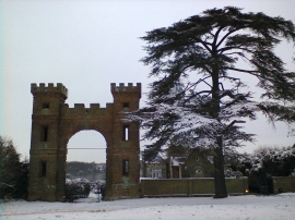
Swanley Bar, Hertfordshire

« Gazetteer Entry
Upload Photo

Swanley Bar, Hertfordshire

  • Parish/Community: North Mymms
  • District/Borough: Welwyn Hatfield
  • County: Hertfordshire
  • Region: Eastern
  • Category: Populated Place
  • Type: Suburban Area
  • Latitude/Longitude: 51°42'40"N 0°11'4"W
  • Eastings/Northings: 525520, 202952
  • OS Grid: TL255029
  • Mapcode Local: GBR JB7.N4V
  • Mapcode Global: VHGPZ.R77Z

Location and coordinates are for the approximate centre of Swanley Bar within this administrative area. Geographic features and populated places may cross administrative borders.

BritishPlaceNames.uk is a Good Stuff website.