-

Monument slope, Netley Park
-
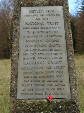
The Robertson Memorial, Netley Park
Monument slope, Netley Park
The Robertson Memorial, Netley Park
Location and coordinates are for the approximate centre of Surrey Hills within this administrative area. Geographic features and populated places may cross administrative borders.