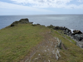
Stoke Point, Devon

« Gazetteer Entry
Upload Photo

Stoke Point, Devon

  • Parish/Community: Newton and Noss
  • District/Borough: South Hams
  • County: Devon
  • Region: South West
  • Category: Geographic Feature
  • Type: Other Coastal Landform
  • Latitude/Longitude: 50°17'40"N 4°1'23"W
  • Eastings/Northings: 255992, 45807
  • OS Grid: SX559458
  • Mapcode Local: GBR Q2.5Y4T
  • Mapcode Global: FRA 28G8.2GK

Location and coordinates are for the approximate centre of Stoke Point within this administrative area. Geographic features and populated places may cross administrative borders.

BritishPlaceNames.uk is a Good Stuff website.