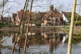
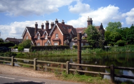
Spring Pond, Harrow

« Gazetteer Entry
Upload Photo

Spring Pond, Harrow

  • Built-Up Area: Harrow
  • Parish/Community: Harrow, unparished area
  • Unitary Authority: Harrow
  • Region: London
  • Category: Water Feature
  • Type: Inland Water
  • Latitude/Longitude: 51°37'31"N 0°19'6"W
  • Eastings/Northings: 516488, 193183
  • OS Grid: TQ164931
  • Mapcode Local: GBR 6V.8C6
  • Mapcode Global: VHGQ9.FDFT

Location and coordinates are for the approximate centre of Spring Pond within this administrative area. Geographic features and populated places may cross administrative borders.

BritishPlaceNames.uk is a Good Stuff website.