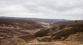
South Grain Beck, County Durham

« Gazetteer Entry
Upload Photo

South Grain Beck, County Durham

  • Parish/Community: South Bedburn
  • Unitary Authority: County Durham
  • Region: North East
  • Category: Water Feature
  • Type: Other Water Feature
  • Latitude/Longitude: 54°40'42"N 1°56'50"W
  • Eastings/Northings: 403500, 531500
  • OS Grid: NZ035315
  • Mapcode Local: GBR GGVB.7N
  • Mapcode Global: WHB3T.2N0Q

Location and coordinates are for the approximate centre of South Grain Beck within this administrative area. Geographic features and populated places may cross administrative borders.

BritishPlaceNames.uk is a Good Stuff website.