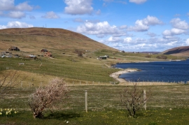
Skeo Taing, Shetland Islands

« Gazetteer Entry
Upload Photo

Skeo Taing, Shetland Islands

  • Unitary Authority: Shetland Islands
  • Region: Scotland
  • Category: Geographic Feature
  • Type: Other Coastal Landform
  • Latitude/Longitude: 60°13'45"N 1°18'51"W
  • Eastings/Northings: 438078, 1149650
  • OS Grid: HU380496
  • Mapcode Local: GBR R13P.VST
  • Mapcode Global: XHD2Y.944T

Location and coordinates are for the approximate centre of Skeo Taing within this administrative area. Geographic features and populated places may cross administrative borders.

BritishPlaceNames.uk is a Good Stuff website.