-
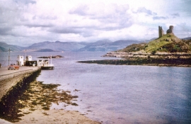
Kyleakin slipway, car ferry and Caisteal Maol
-
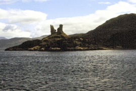
Castle Moil - 1981
Kyleakin slipway, car ferry and Caisteal Maol
Castle Moil - 1981
Location and coordinates are for the approximate centre of Sgeir a' Chaisteil within this administrative area. Geographic features and populated places may cross administrative borders.