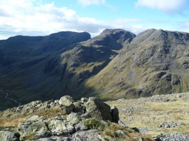
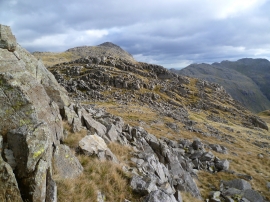
Pike De Bield, Cumbria

« Gazetteer Entry
Upload Photo

Pike De Bield, Cumbria

  • Parish/Community: Wasdale
  • District/Borough: Copeland
  • County: Cumbria
  • Region: North West
  • Category: Geographic Feature
  • Type: Hill or Mountain
  • Latitude/Longitude: 54°27'4"N 3°10'47"W
  • Eastings/Northings: 323598, 506836
  • OS Grid: NY235068
  • Mapcode Local: GBR 6J7Z.C4
  • Mapcode Global: WH70Z.4C1Z

Location and coordinates are for the approximate centre of Pike De Bield within this administrative area. Geographic features and populated places may cross administrative borders.

BritishPlaceNames.uk is a Good Stuff website.