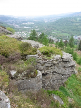
Penrhiw-fer Plantation, Rhondda, Cynon, Taff

« Gazetteer Entry
Upload Photo

Penrhiw-fer Plantation, Rhondda, Cynon, Taff

  • Built-Up Area: Mountain Ash
  • Parish/Community: Mountain Ash
  • Unitary Authority: Rhondda, Cynon, Taff
  • Region: Wales
  • Category: Landcover
  • Type: Forest or Wood
  • Latitude/Longitude: 51°40'43"N 3°23'14"W
  • Eastings/Northings: 304181, 198696
  • OS Grid: ST041986
  • Mapcode Local: GBR HN.5GP4
  • Mapcode Global: VH6DB.72NC

Location and coordinates are for the approximate centre of Penrhiw-fer Plantation within this administrative area. Geographic features and populated places may cross administrative borders.

BritishPlaceNames.uk is a Good Stuff website.