-
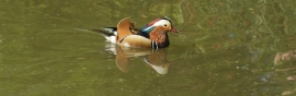
View of a mandarin duck in Peg Lake in the Isabella Plantation #2
-
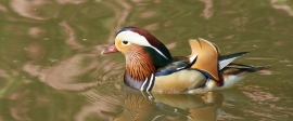
View of a mandarin duck in Peg Lake in the Isabella Plantation
View of a mandarin duck in Peg Lake in the Isabella Plantation #2
View of a mandarin duck in Peg Lake in the Isabella Plantation
Location and coordinates are for the approximate centre of Peg's Pond within this administrative area. Geographic features and populated places may cross administrative borders.