-

St Thomas' church, Upshire
-
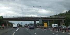
Farm track and footpath crossing the M25 at Upshire
St Thomas' church, Upshire
Farm track and footpath crossing the M25 at Upshire
Location and coordinates are for the approximate centre of Oxleys Wood within this administrative area. Geographic features and populated places may cross administrative borders.