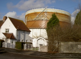
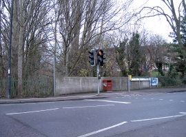
Malago Vale, Bristol, City of

« Gazetteer Entry
Upload Photo

Malago Vale, Bristol, City of

  • Built-Up Area: Bristol
  • Parish/Community: Bristol, City of, unparished area
  • Unitary Authority: Bristol, City of
  • Region: South West
  • Category: Geographic Feature
  • Type: Valley
  • Latitude/Longitude: 51°26'3"N 2°35'55"W
  • Eastings/Northings: 358481, 170758
  • OS Grid: ST584707
  • Mapcode Local: GBR C7S.7P
  • Mapcode Global: VH88T.X61T

Location and coordinates are for the approximate centre of Malago Vale within this administrative area. Geographic features and populated places may cross administrative borders.

BritishPlaceNames.uk is a Good Stuff website.