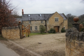
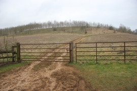
Lower Cockleford, Gloucestershire

« Gazetteer Entry
Upload Photo

Lower Cockleford, Gloucestershire

  • Parish/Community: Elkstone
  • District/Borough: Cotswold
  • County: Gloucestershire
  • Region: South West
  • Category: Populated Place
  • Type: Hamlet
  • Latitude/Longitude: 51°49'21"N 2°2'16"W
  • Eastings/Northings: 397480, 213775
  • OS Grid: SO974137
  • Mapcode Local: GBR 2N5.ML5
  • Mapcode Global: VHB23.MGG4

Location and coordinates are for the approximate centre of Lower Cockleford within this administrative area. Geographic features and populated places may cross administrative borders.

BritishPlaceNames.uk is a Good Stuff website.