-
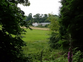
Valley as seen from Chapel Wood
-
Coachman's Cottage in the grounds of Spreacombe Manor
Valley as seen from Chapel Wood
Coachman's Cottage in the grounds of Spreacombe Manor
Location and coordinates are for the approximate centre of Long Plantation within this administrative area. Geographic features and populated places may cross administrative borders.