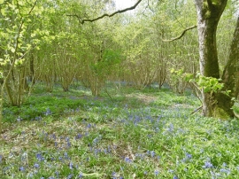
Little Cartway Coppice, East Dorset

« Gazetteer Entry
Upload Photo

Little Cartway Coppice, East Dorset

  • Parish/Community: Berwick St. John
  • Unitary Authority: East Dorset
  • Region: South West
  • Category: Landcover
  • Type: Forest or Wood
  • Latitude/Longitude: 50°57'38"N 2°3'41"W
  • Eastings/Northings: 395782, 117911
  • OS Grid: ST957179
  • Mapcode Local: GBR 2ZL.MND
  • Mapcode Global: FRA 66KK.YHL

Location and coordinates are for the approximate centre of Little Cartway Coppice within this administrative area. Geographic features and populated places may cross administrative borders.

BritishPlaceNames.uk is a Good Stuff website.