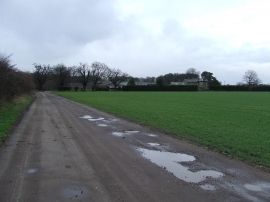
Ling Covert, Suffolk

« Gazetteer Entry
Upload Photo

Ling Covert, Suffolk

  • Parish/Community: Culford
  • District/Borough: St. Edmundsbury
  • County: Suffolk
  • Region: Eastern
  • Category: Landcover
  • Type: Forest or Wood
  • Latitude/Longitude: 52°20'14"N 0°43'21"E
  • Eastings/Northings: 585579, 274532
  • OS Grid: TL855745
  • Mapcode Local: GBR QCV.HGH
  • Mapcode Global: VHKCR.GHTX

Location and coordinates are for the approximate centre of Ling Covert within this administrative area. Geographic features and populated places may cross administrative borders.

BritishPlaceNames.uk is a Good Stuff website.