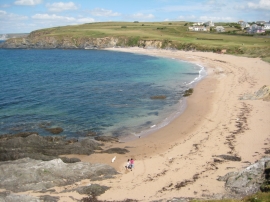
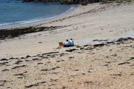
Leas Foot Sand, Devon

« Gazetteer Entry
Upload Photo

Leas Foot Sand, Devon

  • Parish/Community: Thurlestone
  • District/Borough: South Hams
  • County: Devon
  • Region: South West
  • Category: Geographic Feature
  • Type: Beach
  • Latitude/Longitude: 50°15'50"N 3°51'43"W
  • Eastings/Northings: 267388, 42110
  • OS Grid: SX673421
  • Mapcode Local: GBR QB.LX9N
  • Mapcode Global: FRA 28SB.K81

Location and coordinates are for the approximate centre of Leas Foot Sand within this administrative area. Geographic features and populated places may cross administrative borders.

BritishPlaceNames.uk is a Good Stuff website.