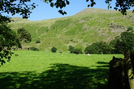
Kilnhow Coppice, Cumbria

« Gazetteer Entry
Upload Photo

Kilnhow Coppice, Cumbria

  • Parish/Community: St John's Castlerigg and Wythburn
  • District/Borough: Allerdale
  • County: Cumbria
  • Region: North West
  • Category: Landcover
  • Type: Forest or Wood
  • Latitude/Longitude: 54°32'59"N 3°3'48"W
  • Eastings/Northings: 331312, 517693
  • OS Grid: NY313176
  • Mapcode Local: GBR 7H1T.KS
  • Mapcode Global: WH70F.XWDX

Location and coordinates are for the approximate centre of Kilnhow Coppice within this administrative area. Geographic features and populated places may cross administrative borders.

BritishPlaceNames.uk is a Good Stuff website.