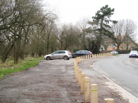
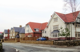
Irongate Bridge Reservoir, North Yorkshire

« Gazetteer Entry
Upload Photo

Irongate Bridge Reservoir, North Yorkshire

  • Built-Up Area: Harrogate
  • Parish/Community: Harrogate, unparished area
  • District/Borough: Harrogate
  • County: North Yorkshire
  • Region: Yorkshire and the Humber
  • Category: Water Feature
  • Type: Inland Water
  • Latitude/Longitude: 53°59'23"N 1°33'37"W
  • Eastings/Northings: 428927, 454950
  • OS Grid: SE289549
  • Mapcode Local: GBR KQJ9.ZJ
  • Mapcode Global: WHC8F.0Z87

Location and coordinates are for the approximate centre of Irongate Bridge Reservoir within this administrative area. Geographic features and populated places may cross administrative borders.

BritishPlaceNames.uk is a Good Stuff website.