-

Large field by Brick Kiln Lane with tractor at work
-
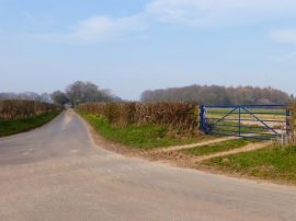
Field entrance at junction of Brick Kiln Lane and unnamed lane
Large field by Brick Kiln Lane with tractor at work
Field entrance at junction of Brick Kiln Lane and unnamed lane
Location and coordinates are for the approximate centre of Inham's Wood within this administrative area. Geographic features and populated places may cross administrative borders.