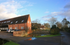
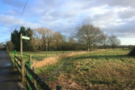
Hare Hatch, Wokingham

« Gazetteer Entry
Upload Photo

Hare Hatch, Wokingham

  • Parish/Community: Ruscombe
  • Unitary Authority: Wokingham
  • Region: South East
  • Category: Populated Place
  • Type: Other Settlement
  • Latitude/Longitude: 51°29'26"N 0°50'30"W
  • Eastings/Northings: 480500, 177500
  • OS Grid: SU805775
  • Mapcode Local: GBR C5F.HZ4
  • Mapcode Global: VHDWP.CS8L

Location and coordinates are for the approximate centre of Hare Hatch within this administrative area. Geographic features and populated places may cross administrative borders.

BritishPlaceNames.uk is a Good Stuff website.