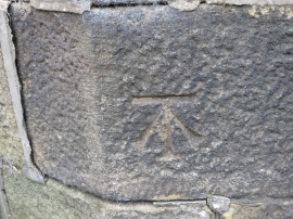
Goose Eye, Bradford

« Gazetteer Entry
Upload Photo

Goose Eye, Bradford

  • Parish/Community: Keighley
  • Unitary Authority: Bradford
  • Region: Yorkshire and The Humber
  • Category: Populated Place
  • Type: Village
  • Latitude/Longitude: 53°51'43"N 1°57'28"W
  • Eastings/Northings: 402871, 440643
  • OS Grid: SE028406
  • Mapcode Local: GBR GRRS.YB
  • Mapcode Global: WHB7V.W6W4

Location and coordinates are for the approximate centre of Goose Eye within this administrative area. Geographic features and populated places may cross administrative borders.

BritishPlaceNames.uk is a Good Stuff website.