-
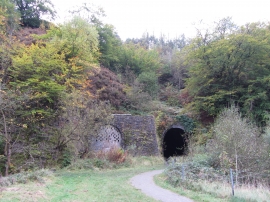
Eastern portals of Gelli-Felen tunnel
-

Old railway trackbed, Clydach Gorge
Eastern portals of Gelli-Felen tunnel
Old railway trackbed, Clydach Gorge
Other current and historical names
Location and coordinates are for the approximate centre of Gellifelen within this administrative area. Geographic features and populated places may cross administrative borders.