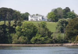
Garden Copse, Devon

« Gazetteer Entry
Upload Photo

Garden Copse, Devon

  • Parish/Community: Stoke Gabriel
  • District/Borough: South Hams
  • County: Devon
  • Region: South West
  • Category: Landcover
  • Type: Forest or Wood
  • Latitude/Longitude: 50°23'53"N 3°36'35"W
  • Eastings/Northings: 285684, 56610
  • OS Grid: SX856566
  • Mapcode Local: GBR QR.G87M
  • Mapcode Global: FRA 37BZ.TS2

Location and coordinates are for the approximate centre of Garden Copse within this administrative area. Geographic features and populated places may cross administrative borders.

BritishPlaceNames.uk is a Good Stuff website.