-

Site of Gailey station
-
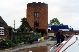
Gailey Lock 32 by the A5 Staffs and Worcester Canal
Site of Gailey station
Gailey Lock 32 by the A5 Staffs and Worcester Canal
Other current and historical names
Location and coordinates are for the approximate centre of Gailey within this administrative area. Geographic features and populated places may cross administrative borders.