-

Part of the formal garden, Harewood House
-
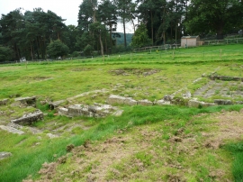
Part of the foundations of Gawthorpe Hall, Harewood House
Part of the formal garden, Harewood House
Part of the foundations of Gawthorpe Hall, Harewood House
Location and coordinates are for the approximate centre of Fish Pond within this administrative area. Geographic features and populated places may cross administrative borders.