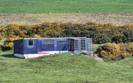
Esperley Lane Ends, County Durham

« Gazetteer Entry
Upload Photo

Esperley Lane Ends, County Durham

  • Parish/Community: Cockfield
  • Unitary Authority: County Durham
  • Region: North East
  • Category: Populated Place
  • Type: Other Settlement
  • Latitude/Longitude: 54°36'55"N 1°47'32"W
  • Eastings/Northings: 413500, 524500
  • OS Grid: NZ135245
  • Mapcode Local: GBR HHX2.Q8
  • Mapcode Global: WHC5D.F8P1

Location and coordinates are for the approximate centre of Esperley Lane Ends within this administrative area. Geographic features and populated places may cross administrative borders.

BritishPlaceNames.uk is a Good Stuff website.