-
Sgealtrabhal stone row
-

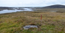
Lochs below Crogary Mor and Maari
Sgealtrabhal stone row
Lochs below Crogary Mor and Maari
Location and coordinates are for the approximate centre of Eilean Dubh Mòr within this administrative area. Geographic features and populated places may cross administrative borders.