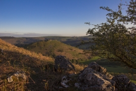
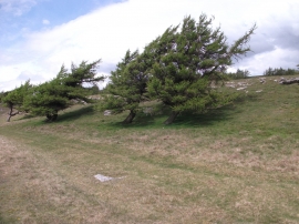
Eglwyseg Plantation, Denbighshire

« Gazetteer Entry
Upload Photo

Eglwyseg Plantation, Denbighshire

  • Parish/Community: Llantysilio
  • Unitary Authority: Denbighshire
  • Region: Wales
  • Category: Landcover
  • Type: Forest or Wood
  • Latitude/Longitude: 52°59'15"N 3°9'7"W
  • Eastings/Northings: 322764, 343989
  • OS Grid: SJ227439
  • Mapcode Local: GBR 6Z.HW97
  • Mapcode Global: WH784.K58D

Location and coordinates are for the approximate centre of Eglwyseg Plantation within this administrative area. Geographic features and populated places may cross administrative borders.

BritishPlaceNames.uk is a Good Stuff website.