-
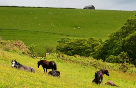
Dartmoor Ponies near the coast at Lansallos, Cornwall
-

East Combe
Dartmoor Ponies near the coast at Lansallos, Cornwall
East Combe
Location and coordinates are for the approximate centre of East Coombe within this administrative area. Geographic features and populated places may cross administrative borders.