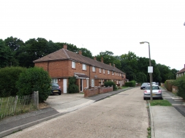
East Cookham Wood, Gravesham

« Gazetteer Entry
Upload Photo

East Cookham Wood, Gravesham

  • Built-Up Area: Rochester
  • Parish/Community: Medway, unparished area
  • Unitary Authority: Gravesham
  • Region: South East
  • Category: Landcover
  • Type: Forest or Wood
  • Latitude/Longitude: 51°21'40"N 0°29'46"E
  • Eastings/Northings: 573885, 165411
  • OS Grid: TQ738654
  • Mapcode Local: GBR PQ1.L8W
  • Mapcode Global: VHJM0.K15T

Location and coordinates are for the approximate centre of East Cookham Wood within this administrative area. Geographic features and populated places may cross administrative borders.

BritishPlaceNames.uk is a Good Stuff website.