-

The Royal Oak Pub, Dilhorne, Caverswall
-
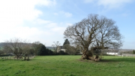
Ancient tree above Dilhorne Church
The Royal Oak Pub, Dilhorne, Caverswall
Ancient tree above Dilhorne Church
Other current and historical names
Location and coordinates are for the approximate centre of Dilhorne within this administrative area. Geographic features and populated places may cross administrative borders.